Home » Posts filed under Mountain
The Nordwand, German for "north wall" or "north face," is the spectacular north (or, more precisely, northwest by north) face of the Eiger (also known as the Eigernordwand: "Eiger north wall" or Eigerwand). It is one of the three great north faces of the Alps, along with the north faces of the Matterhorn and the Grandes Jorasses (known as 'the Trilogy'). It is about 1,800 m (5,900 ft) tall and overlooks Kleine Scheidegg and Grindelwald. At 2,866 metres inside the mountain lies the Eigerwand railway station. The station is connected to the north face by a tunnel opening at the face, which has sometimes been used to rescue climbers. The Eiger Trail, at the base of the north face, runs from Eigergletscher to Alpiglen railway stations.
It was first climbed on July 24, 1938 by Anderl Heckmair, Ludwig Vörg, Heinrich Harrer and Fritz Kasparek, a German–Austrian group. The group had originally consisted of two independent teams; Harrer and Kasparek were joined on the face by Heckmair and Vörg, who had started their ascent a day later and had been helped by the fixed rope that the lead group had left across the Hinterstoisser Traverse. The two groups, led by the experienced Heckmair, cooperated on the more difficult later pitches, and finished the climb roped together as a single group of four.
Close view of the north face from the west ridge
A portion of the upper face is called "The White Spider", as snow-filled cracks radiating from an ice-field resemble the legs of a spider. Harrer used this name for the title of his book about his successful climb, Die Weisse Spinne (translated into English as The White Spider: The Classic Account of the Ascent of the Eiger). During the first successful ascent, the four men were caught in an avalanche as they climbed the Spider, but all had enough strength to resist being swept off the face.
Since then, the north face has been climbed many times. Today it is regarded as a formidable challenge more because of the increased rockfall and diminishing ice-fields than because of its technical difficulties, exceeded by the 8,000 m peaks in the Himalaya and Karakoram. Climbers are increasingly electing to challenge the Eiger in winter, when the crumbling face is strengthened by ice.
Since 1935, at least sixty-four climbers have died attempting the north face, earning it the German nickname, Mordwand, or "murderous wall", a play on the face's German name Nordwand.
While the summit was reached without much difficulty in 1858 by a complex route on the west flank, the battle to climb the north face has captivated the interest of climbers and non-climbers alike. Before it was successfully climbed, most of the attempts on the face ended tragically and the Bernese authorities even banned climbing it and threatened to fine any party that should attempt it again. But the enthusiasm which animated the young talented climbers from Austria and Germany finally vanquished its reputation of unclimbability when a party of four climbers successfully reached the summit in 1938 by what is known as the "1938" or "Heckmair" route.
Full Post
The Inca Trail to Machu Picchu consists of three overlapping trails: Mollepata, Classic, and One Day. Mollepata is the longest of the three routes with the highest mountain pass and intersects with the Classic route before crossing Warmiwañusqa ("dead woman"). Located in the Andes mountain range, the trail passes through several types of Andean environments including cloud forest and alpine tundra. Settlements, tunnels, and many Incan ruins are located along the trail before ending the terminus at the Sun Gate on Machu Picchu mountain. The two longer routes require an ascent to beyond 4,200 metres (13,800 ft) above sea level, which can result in altitude sickness.
Concern about overuse leading to erosion has led the Peruvian government to place a limit on the number of people who may hike this trail per season, and to sharply limit the companies that can provide guides. As a result, advance booking is mandatory. A maximum of 500 people are allowed on the trail each day, of which only 200 are trekkers, the rest being guides and porters. As a result, the high season books out very quickly.
The trail is closed every February for cleaning. This was originally done informally by organizations such as South American Explorers but is now managed officially. As the trail ascends toward Warmi Wañusqa, or "Dead Woman's Pass", which resembles a supine woman, it passes through differing habitats, one of which is a cloud forest containing Polylepis trees. The campsite at Llulluch'apampa (Llulluchapampa) is located on this stretch of trail at 3,800 metres (12,500 ft). The pass itself is located at 4,215 m (13,829 ft) above sea level, and is the highest point on this, the "Classic" trail.
After crossing the pass the trail drops steeply into the Pakaymayu drainage. At a distance of 2.1 km and 600 m below the pass is the campground Pakaymayu. Intipata (aka Yunkapata)[9] is a recently uncovered extensive set of agricultural terraces which follow the convex shape of the terrain. Potatoes, maize, fruit, and sweet potato were grown here.
The name win-yay-way-na is used to refer to both a hostel–restaurant–camp site and a set of Inca ruins. Two groups of major architectural structures, a lower and upper, are set among multiple agricultural terraces at this concave mountainside site. A long flight of fountains or ritual baths utilizing as many as 19 springs runs between the two groups of buildings.
Full Post
The Blue Mountains is a mountainous region in New South Wales, Australia. It borders on Sydney's metropolitan area, its foothills starting approximately 50 kilometres (31 mi) west of the state capital. The area begins on the west side of the Nepean River and extends westward as far as Coxs River. Geologically, it is situated in the central parts of the Sydney basin.
Consisting mainly of a sandstone plateau, the area is dissected by gorges up to 760 metres (2,490 ft) deep. The highest point of the range is Mount Werong at 1,215 metres (3,986 ft) above sea level. A large part of the Blue Mountains is incorporated into the Greater Blue Mountains Area World Heritage Site, consisting of seven national park areas and a conservation reserve.
The Blue Mountains area includes the local government areas of the City of Blue Mountains, the City of Hawkesbury, the City of Lithgow and Oberon.
The Blue Mountains are a popular destination for Rock Climbers, Mountain Bikers and Hikers as well as canyoning and other adventure sports. These sports are well catered for by guiding companies and equipment stores located mainly in Katoomba.
Popular climbing destinations include the Centennial Glen cliffs near Blackheath, Mount Victoria, Mount Piddington and Mount Boyce. Climbing is currently banned on The Three Sisters.
Mountain biking takes place mainly on the many fire trails that branch away from the main spine of the Great Western Highway, such as Narrow Neck, Anderson's Fire Trail and others.
Likewise many of the fire trails are popular with day hikers, though many dedicated walking trails exist away from the fire roads
Full Post
Mount Merapi, is a conical volcano located on the border between Central Java and Yogyakarta, Indonesia. It is the most active volcano in Indonesia and has erupted regularly since 1548. Its name means Mountain of Fire. It is very close to the city of Yogyakarta, and thousands of people live on the flanks of the volcano, with villages as high as 1700 m above sea level.
Merapi is the youngest in a group of volcanoes in southern Java.
Full Post
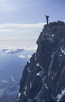 The First Conquer's Of The Mount Everest
English climbers were the first ones to conquer the Mouth Everest debacle. Before World War IInd, three English expeditions were sent to the north of Himalayas, which is the Tibetan side of the Mount Everest. Twice the climbers reached the altitude of 8,600m, but unfortunately failed to summit.
The southern side of the Mount Everest, that is the Nepalese side of the mountain was opened to the mountaineers after World War IInd. After the occupation of Tibet by China, the mountaineering expeditions toward Mount Everest began from the Nepalese side.
Full Post




