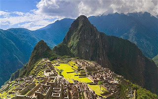
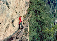
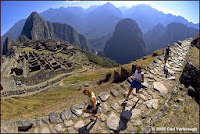
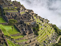
The Inca Trail to Machu Picchu consists of three overlapping trails: Mollepata, Classic, and One Day. Mollepata is the longest of the three routes with the highest mountain pass and intersects with the Classic route before crossing Warmiwañusqa ("dead woman"). Located in the Andes mountain range, the trail passes through several types of Andean environments including cloud forest and alpine tundra. Settlements, tunnels, and many Incan ruins are located along the trail before ending the terminus at the Sun Gate on Machu Picchu mountain. The two longer routes require an ascent to beyond 4,200 metres (13,800 ft) above sea level, which can result in altitude sickness.
Concern about overuse leading to erosion has led the Peruvian government to place a limit on the number of people who may hike this trail per season, and to sharply limit the companies that can provide guides. As a result, advance booking is mandatory. A maximum of 500 people are allowed on the trail each day, of which only 200 are trekkers, the rest being guides and porters. As a result, the high season books out very quickly.
The trail is closed every February for cleaning. This was originally done informally by organizations such as South American Explorers but is now managed officially. As the trail ascends toward Warmi Wañusqa, or "Dead Woman's Pass", which resembles a supine woman, it passes through differing habitats, one of which is a cloud forest containing Polylepis trees. The campsite at Llulluch'apampa (Llulluchapampa) is located on this stretch of trail at 3,800 metres (12,500 ft). The pass itself is located at 4,215 m (13,829 ft) above sea level, and is the highest point on this, the "Classic" trail.
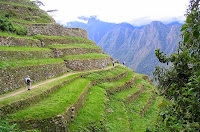
After crossing the pass the trail drops steeply into the Pakaymayu drainage. At a distance of 2.1 km and 600 m below the pass is the campground Pakaymayu. Intipata (aka Yunkapata)[9] is a recently uncovered extensive set of agricultural terraces which follow the convex shape of the terrain. Potatoes, maize, fruit, and sweet potato were grown here.
The name win-yay-way-na is used to refer to both a hostel–restaurant–camp site and a set of Inca ruins. Two groups of major architectural structures, a lower and upper, are set among multiple agricultural terraces at this concave mountainside site. A long flight of fountains or ritual baths utilizing as many as 19 springs runs between the two groups of buildings.

